Key Activities
Geospatial Imagery Information
NGII produces a variety of national geospatial imagerythrough high-resolution aerial photograph technology
Digital Elevation Model
NGII establishes the relief displacement of geography into a digital elevation model on 1m x 1m, 5m x 5m or 10m x 10m grid by using aerial images, LiDAR and digital topographic map
-
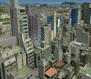
[ 3-D Geospatial Information ]
-
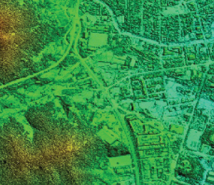
[ DSM ]
-
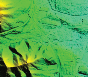
[ DEM ]
The DEM is utilized in fields such as earth. The DEM has been applied to volume calculation, topographic analysis and selection of appropriate land
| 1X1m | 5X5m | 10X10m | 90X90m |
|---|---|---|---|
| Seoul, Gyeonggi Province and parts of six metropolitan areas (not open to public) |
Entire country (not open to public) |
Entire country (open to public) |
|