Key Activities
Mapping
NGII lays the foundation for convergence of Various industrial fields through the production of customized maps to serve the diverse needs of people
- Topographic Map
- National Internet Map
- Geospatial Information of
North & South Poles - High Definition Road Map
Large-scale Digital Topographic Map(1:1,000)
Producing digital topographic maps through matching funds (50:50) with local governments for urban areas
Produced maps for 82 cities spanning apporx. 9,000㎢ and suburb areas spanning 50 ㎢
National Base Map(Digital Topographic Map on Scale of 1:5,000)
Revising all information on national base map every two years and important data such as large buildings and roads every two weeks
No. of map: 18,074 sheets
Paper Topographic Map
-
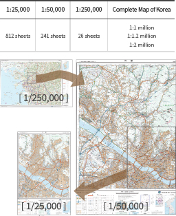
[ Paper Topographic Map ]
-
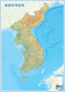
[ Complete Map of Korea ]
-
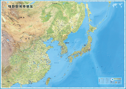
[ Map of Korea and Vicinity ]
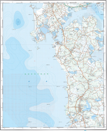
Coastal area base map
Producing 1:25,000 scale topographic maps including coastal areas with information on water depth and sediments displayed
World Map[Robinson Projection]
Projection: Producing world maps in Korean using Mercator’s, Robinson, Eckert’s, Winkel Tripel and Goode homolosine projections
Multiple languages: Producing world maps in English, French, Spanish, Portuguese and Arabic using Robinson projection
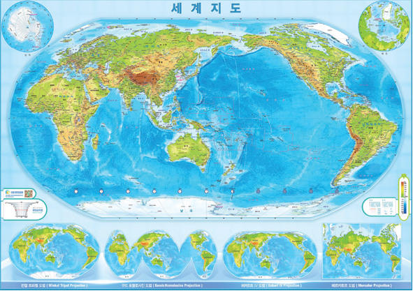
[ Robinson Projection ]
Mapping of North Korea [Production Status (late 2016)]
NGII digitally maps North Korea using satellite image in 1:25,000 scale and major areas of North Korea in 1:5,000 scale
| 1/5,000 | 1/25,000 | 1/50,000 |
|---|---|---|
| 254 sheets | 2,525 sheets | 557 sheets |
Pyongyang
-
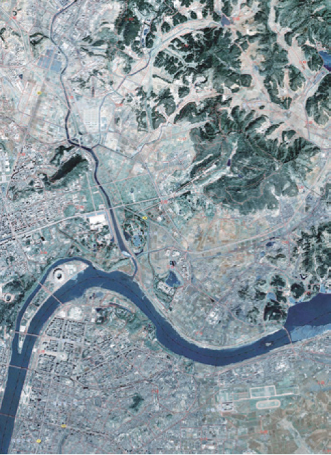
[ Orthogonal Imagery Map ]
-
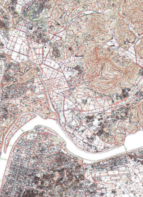
[ 1:25,000-scale Topographic Map ]