Key Activities
Geospatial Imagery Information
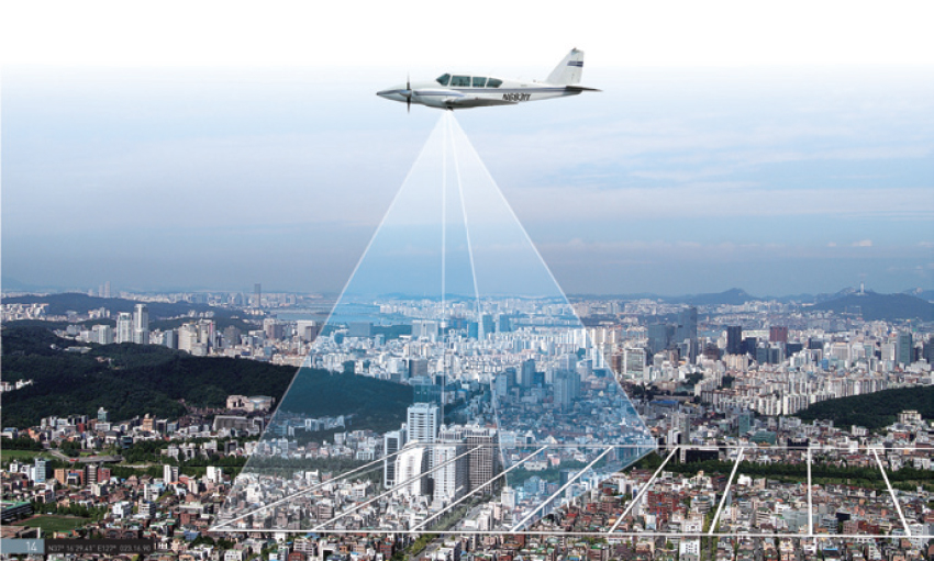
NGII produces a variety of national geospatial imagerythrough high-resolution aerial photograph technology
Aerial Photography
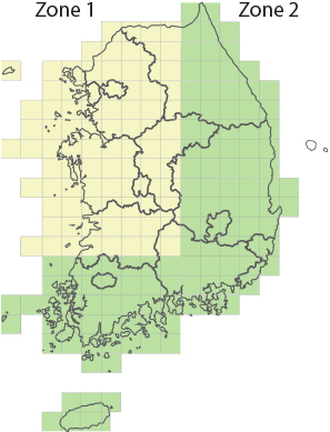
NGII carries out the aerial surveying to build up the whole aerial photography DB of 25cm resolution every 2 year
- Degree of photo overlapping
- horizontal overlapping over 60%
vertical overlapping over 30%
- Altitude
- 2,000~3,000meters
- No. of images possessed
- 1940-60s: 78,091
1970-90s: 107,763
2000-present: 709,018
NGII builds up the time series aerial photograph DB and orthogonal imagery DB to detect the change of land and geographical features.
The aerial photograph has been applied to the various systems such as internet portal maps, especially for use in civil affair documents.
[ Detecting the change of land and geographical features ]