Key Activities
National Geodetic Datum
In determining national coordinate reference system, NGII provides high quality information on geodetic surveying
- Korean Geodetic Datum
- National Geodetic Reference Framework
- Space Geodetic Control Point
- CORS(Continuously Operating Reference Stations)
National Geodetic Reference Framework
Establishing and maintaining national control points nationwide (horizontal and vertical position) by using the state-of-art geodetic technologies
National control points are mainly used for civil engineering (measurement for construction) and also applied to the earth diastrophism and real-time location based service
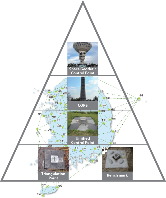
[ Hierarchy of National Control Point ]