Key Activities
National Geodetic Datum
Korean Geodetic Datum
Horizontal Datum: Establishing the national geodetic horizontal origin point in accordance with the World Geodetic Reference System (ITRF2000 & GRS80) and installing space geodetic control points satellite station, integrated control points and triangulation points
Vertical Datum: Determining the height of the national vertical origin point(Inha Technical College) as 26.6871meters based on the mean sea level of Incheon Bay and installing integrated control points and bench marks
National Geodetic Reference Framework
Establishing and maintaining national control points nationwide (horizontal and vertical position) by using the state of art geodetic technologies
National control points are mainly used for civil engineering (measurement for construction) and also applied to the earth diastrophism and real-time location based service
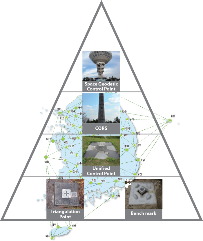
[ Hierarchy of National Control Point ]