Key Activities
Mapping
NGII lays the foundation for convergence of Various industrial fields through the production of customized maps to serve the diverse needs of people
- Topographic Map
- National Internet Map
- Geospatial Information of
North & South Poles - High Definition Road Map
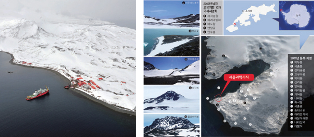
Geospatial Information of North & South Poles
NGII had built the control point around scientific station in Antarctica in 2009, and mapped the whole of Antarctic area in 1:1,000, 1:5,000 and 1:25,000 scale and also officially registered geographical names in 2011 and 2012
NGII had mapped the arctic area in 1:5,000 and 1:25,000, built up the orthogonal imagery and digital elevation models since 2014 for supporting the exploration of Arctic resources
-
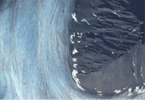
[ Svalbard islands orthogonal image on scale of 1:5,000 ]
-
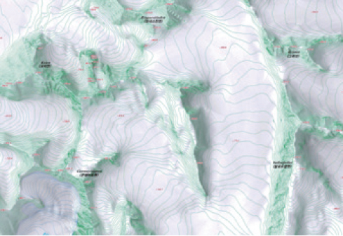
[ Svalbard islands digital topographic map on scale of 1:25,000 ]